VIS-AIMS
Land monitoring system using remote sensing and artificial intelligence techniques.
Sistema de monitorización del territorio utilizando teledetección y técnicas de inteligencia artificial
The overall objective of the project is to develop a territorial monitoring system, based on the use of artificial intelligence techniques for the processing of geospatial data, taking the municipality of San Miguel de Salinas as the study area. This municipality meets a series of conditions that made it ideal for this research project, as it has a population of less than 10,000 inhabitants (6,034 inhabitants in 2019), the lowest population density in the Vega Baja region (110 inhabitants per km2), a high proportion of the municipality dedicated to agriculture, along with an incipient tourist offer, with notable urbanized areas near the coast and numerous action projects for urban development.
Four specific objectives (SO) were established, the completion of which was necessary to achieve the complete execution of the research project. These specific objectives, as well as a brief description of how their implementation has been carried out, are shown below:
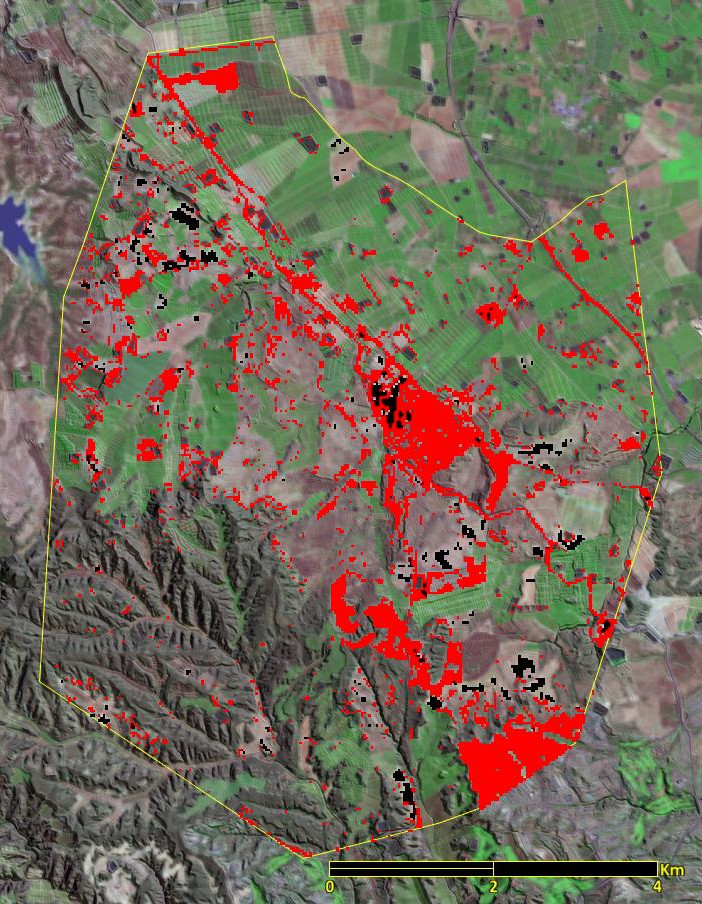
- OE1. Historical analysis of land cover changes using machine learning techniques. Mapping of land uses and land covers was carried out, using a Landsat image repository, between the years 2005 and 2023. Thanks to the extensive work of evaluating covers in the study area, and the use of machine learning techniques (ML) it was possible to develop multi-temporal cartography, fusing multi-seasonal images, which made it possible to achieve global cartography pressures of up to 89%. Furthermore, the analysis of land cover changes allowed us to know the temporal dynamics of territory occupation, information that is very useful to promote more sustainable territory management.
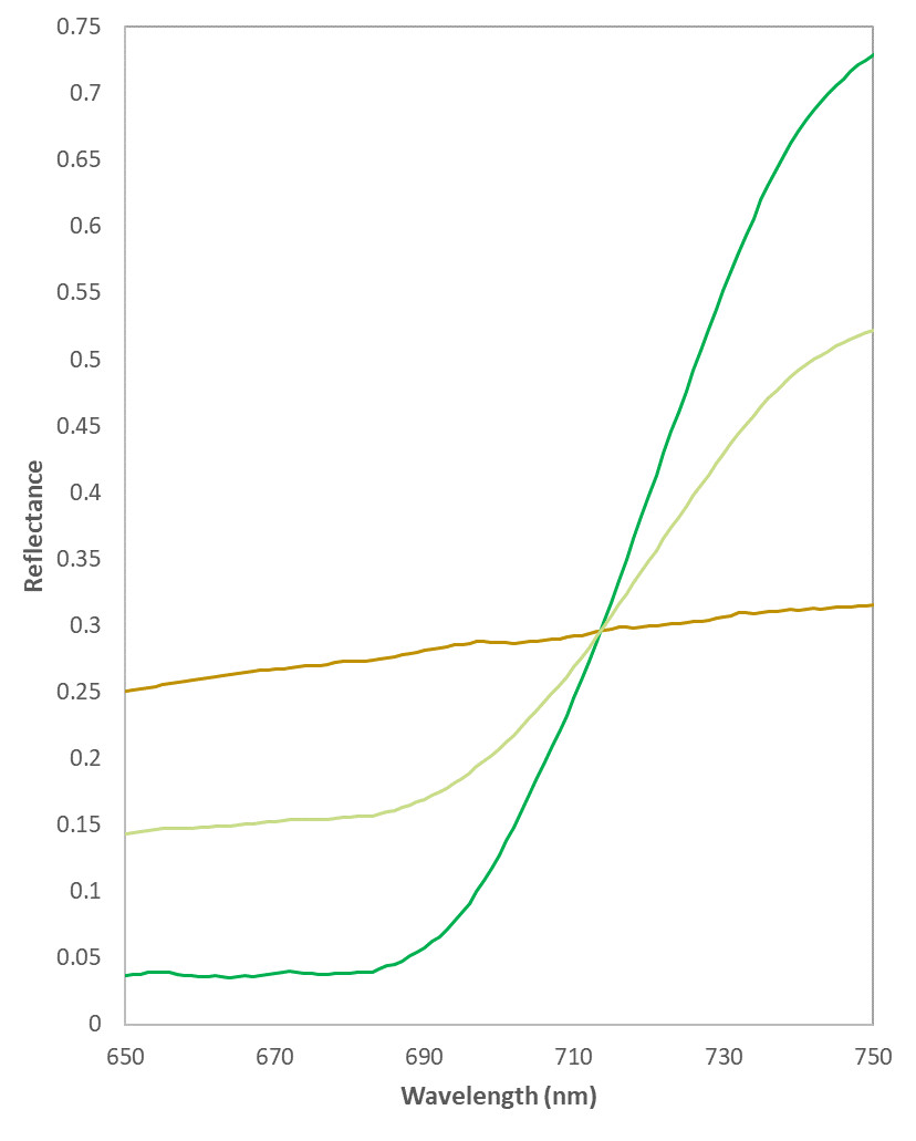
- OE2. Development of a spectral library of land covers in the study area. Radiometry campaigns of the most representative soil covers of the study area were developed, collecting spectral information from different types of soils, crops, forest vegetation, xerophytic shrublands, etc. For this purpose, the available visible and infrared spectroradiometry (VNIR) system was used. Based on the spectra of unique materials obtained (i.e., reference spectra), various modeling of spectral mixtures was carried out, in order to infer the behavior of such covers when observed by satellite images of medium spatial resolution.
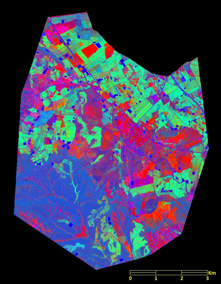
- OE3. Application of artificial intelligence techniques for mapping soil cover fractions in the study area. A multi-temporal modeling of three cover fractions (soil-water-vegetation) was developed, using linear spectral unmixing techniques. An extensive repository of VNIR multispectral images from the Sentinel-2 satellites was used, which allowed spatio-temporal monitoring of changes in cover fractions. Data mining techniques were used to identify the areas most affected by changes in cover fractions, evaluating the origin of said changes.
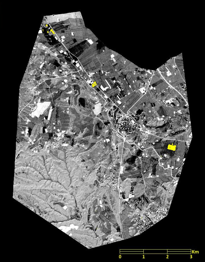
- OE4. Implementation of an automated soil cover monitoring system. In this last phase of work, an automated system for calculating environmental variables using satellite images for the study area has been developed, which can be publicly consulted at the link https://www.meren.es/vis-aims/. On this platform, where the results of the research funded by the Alicante Provincial Council are published, it is possible to consult updated information on the state of the vegetation, soil humidity and soil sealing, obtained through different spectral indices calculated based on the temporary availability of multispectral images from the Sentinel program of the European Space Agency (ESA).